Theme Preview Rss

WARRIOR DASH!!!

Many of you who know me, know that I love (a) to dress up, (b) to run and (c) a good party. So, when you put it all together, there was no way I was missing out on Warrior Dash-- a barbarian-themed run up and down Copper Mountain filled with obstacles (such as a mud pit, rope climb, etc) and followed by a rocking after party. This race was meant to just have fun and release energy. And it was. And we did.

Earlier in the year, we recruited some friends to "dash" with us. We had a really fun bunch of peeps that were set to make a day out of it-- costumes and all. So this week, Cassidy, Lee-Anne and I had got together and made warrioress costumes. It is amazing what you can do with things in your basement: old bike tubes, spray paint, a glue gun, random pieces of fabric, etc. Don't believe me?
Made from gold-spray painted bike tubes.

A painted piece of styrofoam stapled to bike tubes. Skull hot glued to the front.

To properly hydrate ourselves for the event, we made sure we had a fully stocked cooler and started drinking early. Yum. Ironically, the G2 isn't what we drinking before the event.
Not pictured, pitcher of Ross' margaritas. Double yum.

Happy as can be, we made our way onto the bus and into the town center.
Dude in yellow=the first of many, many random friends we made throughout the day!

We got to the town center and warriors from earlier waves were already washing off in the pond. The town was filled with energy and happy warriors and warrior-to-be's.

We checked in, got our stuff and got ready. We were very excited about being there, the atmosphere was great and we chatted it up with about everyone we saw.
More new friends-- I can't wait to get all muddy!

Ready to Dash!

Starting line!

The gun went off and there was some fire spewing out of the entry gates. We started running, then had to crawl over some abandoned cars (obstacle #1), then a little further it was climbing up a hill and a wall, then climbing over hay bales. What fun warrior dashing is.

Then it was time to conquer the hill. Lots of running up, up, up. It is here where we kind of divided into two groups: Mary, Cindy, Ross and me and then Lee-Anne, Ray, Andrea and Ryan. The crowd kinda slowed and we had plenty of time to make even more friends.
Avatars Running!

Ross' new BFF, Tanner. He was awesome.

Picture of us at the top-- party already going on below.

Then, it was a quick jaunt DOWN the mountain. FUN! At the bottom, there was a water station and more fun obstacles to conquer.

Here is what I had been looking forward to all day-- MUD PIT! I let Ross, Cindy and Mary go ahead so I could snap a picture. Then a volunteer took my camera for me (bless her) and I dove into the mud pit. Cheers EVERYWHERE!!! This crowd liked a good belly flop. I had some time to make up if I was going to tackle Ross before he got out of the pit. I got up right behind him and tugged on his leg, trying to take him down. No luck. But some mud-flinging did take place and we ended up as dirty as could be.
The mud pit after pict.

It was at this point I decided to thank EVERY volunteer on the course with a proper mud-filled hug. I earned it, they loved it, we were all happy!

More running, then more obstacles-- crawling through tunnels (the one time in life being short was actually to my advantage!), some jumping over walls (height NOT to my advantage), rope climbing, walking over planks, and then a stream crossing. Ahhh!!! rinsing off a bit. Not too much, though. Actually, no matter how much washing I was doing, the mud was going to be there. Seriously.

Then it was downhill till the end. We got there, well almost there, and Mary had stopped to get rocks out of her shoe. So Ross, Cindy and I went back to find her. They (Ross, Cindy and Mary) then turned around to finish it and I told them I was gonna run back up to find Lee-Anne, Ray, Andrea and Ryan.

So I ran and I ran and I ran... the opposite direction. Through the obstacles backwards (gotta get my money's worth, right?). And just about EVERYONE yelled at me that I was going the wrong way, to which I answered, "A warrior leaves no one behind!" (GI Jane was on TNT earlier this week). Till I found my friends-- muddy and jumping over walls.
A re-uniting picture!

We re-grouped and I convinced them, too, to hug every volunteer, to which they did. Man, did they love us on the course!
Close-up of us all lovin' on Ralph, who happened to be my personal favorite volunteer. Notice the mud on his shirt-- that was from me earlier.

Since I had washed my camera in the stream, I could get some more picts.
Muddy cargo net climbing

I think this picture is priceless.

From there, it was over a few more obstacles, across the planks, over the stream, down the hill (deja vu).

Then, the final obstacle-- FIRE JUMPING! Now, I thought, whatev... TILL I SAW IT! These flames were high! It was kinda (read:really) scary. I was glad my buzz had tamed itself a little bit or I could've been in some real trouble. I went ahead so I could get the official "fire-jumping" pictures.
Andrea jumping the fire!

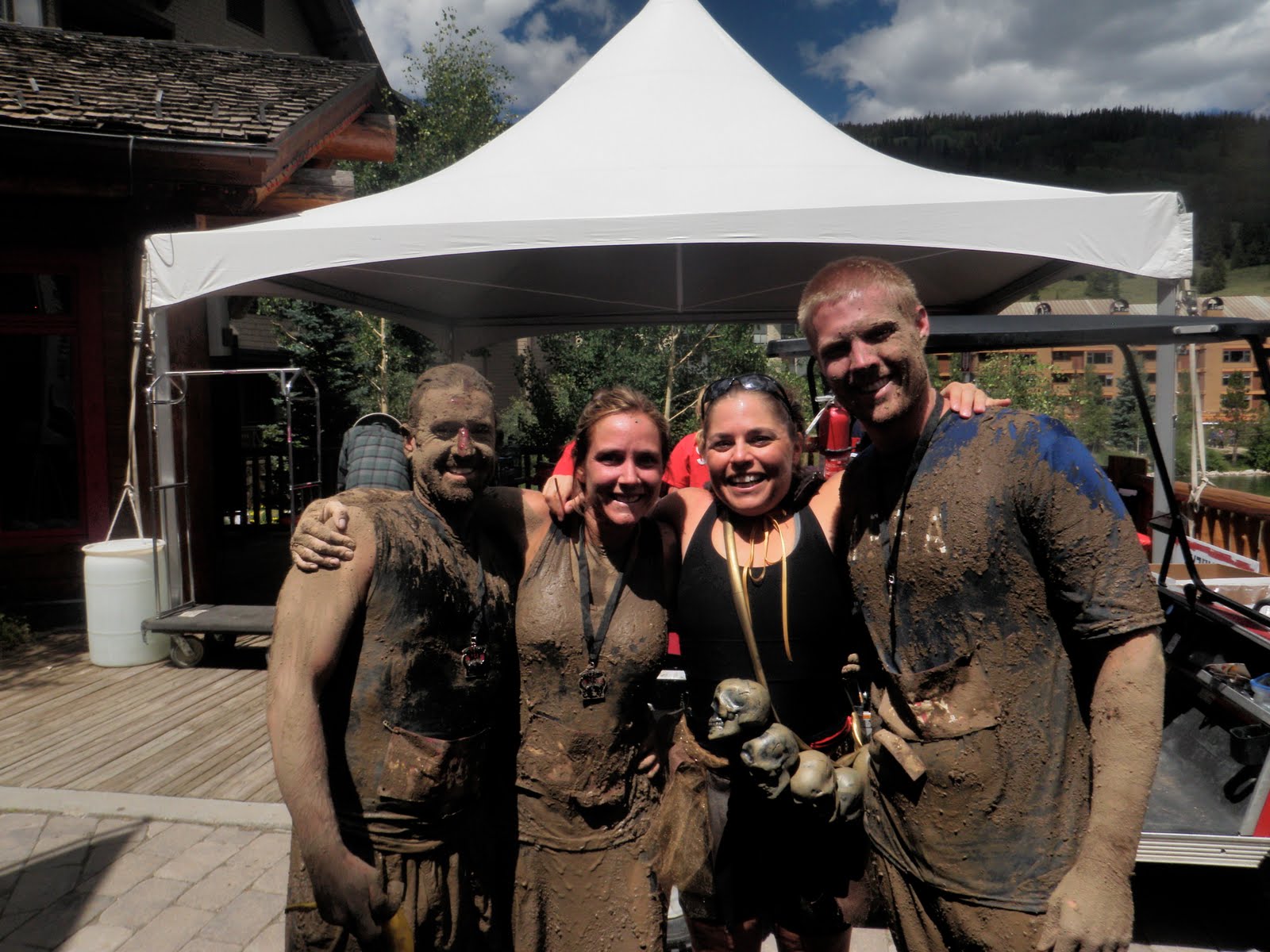
THE FINAL AFTER PICT! ROAR!

Now it was time to kick back, relax and enjoy the party-- Warrior Style!

Sharing a turkey leg. Yum.

Chillaxin' with our loin cloth covered friends.

Tin Man rocks our free world.

Can't forget my favorite warrior.

WHAT A FUN DAY-- Thanks to our whole warrior crew and everyone we met in between! ...I can't believe I have NO pictures of Marvin-- next time, dude.

CRMBT: Day 4. Peak to Peak HWY

So, here I am day 4 of the trip and beat. This has been hard. Harder than expected, but that is my fault in that I truly didn't really look over the route much ahead of time-- I was just along for the ride. And what a ride it was.

All night last night, Bill was saying "tomorrow will be a recovery day". I looked at the route. Umm... not really. It starts with a 15-mile climb up Golden Gate Highway that looked rough, followed only by 60 miles of challenging ups and downs, before we hit Estes. I didn't want to say anything because for once it was nice not to get all worked up about the following day and how it was going to be harder than before. But I was feeling it. And worried about my quads.

Got up that morning and was hot to trot. As we were making our way out we ran into Jeff, who was going to sag up to the second aid station (mile 33) and go from there. Smart man, I thought. Jane and Bill weren't in a rush, so Joan, Sue and I started off. Started riding and wasn't feeling it today. Mentally, my highlight was yesterday. This was our last day and we wanted to make it fun. But would it be really with all this climbing again?

We got about 3 miles in when I saw a sag wagon stopped and loading up a couple of people. I asked Sue and Joan if they would want to sag to the first aid station and they agreed happily. We were elated. All of us.
Happy as can be to be hanging with Kevin, the most wonderful driver, EVA!

As we got in Jane and Bill saw us, they stopped, but opted to make the climb. Suckers! I mean, good for them.

We got to the aid station and got out to continue our journey.
Ready to roll! See those far, far mountains, that's where we're going!

For the next 60-ish miles we went up, up and down, down. We saw some of the most beautiful stuff and we stopped to take pictures and enjoy one another's company-- something we hadn't been able to do on the previous days. It was great.

Look, I see them! Mountains in the distance!

Pretty, pretty, everywhere!

And here we are enjoying it!

Just call her "Joan, Queen of the Mountain!"


Gorgeousness all around!

More scenery = more photo opps

Second to last climb conquered!

View of Longs Peak as we rode by.

Last stop at Lily Lake. Ahhh!

And from Lily Lake, it was time to go into Estes and complete our trip. Overall, it was a great day. Peak to Peak Highway was beautiful and I am glad that I did not overdue it on my last day of riding in the mountains by riding all the way up Golden Gate Highway. I have this little thing called Ironman coming up in a month's time and needed to be smart enough to know when was enough-- and I was. On top of that, regardless of my tone in this blog or the picts we took, Peak to Peak Highway was NO PIECE OF CAKE and so I had plenty to challenge me on this day.

Coming into Estes, I had a few pleasant and fun surprises in store for me.
Ross came up to spend the night and next day with us. How I missed him.

Margaritas with the girls! Need to replenish my salt intake, right?

CRMBT: Day 3. MT EVANS!?!?!?!?!

So, here I am, day 3 of the tour and the climb up Mt. Evans. The one I have been dreading, I mean anticipating.

Mt. Evans is a 14'er. That means making it to the top would be 2,000 feet more climbing than I have ever done and considering that that climb was just on Tuesday... not to mention that the climb would be at 14,000 feet and I was told one of the real challenges would be the thinness of the air. Oh, and did I mention we were starting somewhere around 7,000 feet? But, I was promised beauty beyond belief and getting to see long-horned sheep in their natural habitat. Ok, I can do this. Bring it on.

The day started off, and stayed, pretty much by myself. Sue and I were staying outside of town and by the time we got bussed back, Jane, Joan and Bill had left. Sue and I didn't bike the same pace, so after a warm-up, we quickly split up.

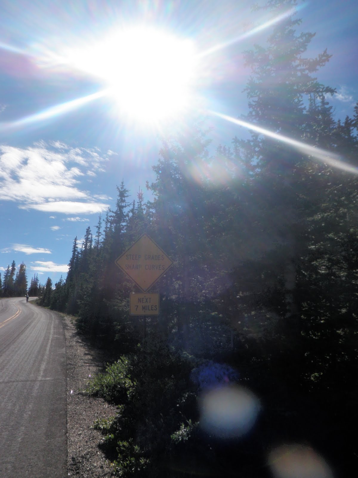
The climb from Idaho Springs to Echo Lake was 13 miles. About 6 miles in I saw this sign.In case you can't read it, it says: Sharp Curves - Steep Grade - Next 7 miles. Just what I need. :) So, I plug along, remembering that (in all) it is a 28 mile climb... if I get to the top of Mt. Evans.
How I am feeling. I didn't say this was easy.

But, 13 miles in, I come to Echo Lake. Very beautiful.
Yes, I am aware this is not straight, I was riding and taking pictures. That's what I do.

And then I have a decisions to make:Go up Mt. Evans or continue on? I stopped briefly at the aid station to refill. I talked to one guy who had climbed Mt. Evans a lot and he told me "the first 3-4 miles are like what we just did, then you get above treeline and there are long, windy switchbacks. About mile 8 you hit Summit Lake and if you get that far... you're going to the top." He also said with the weather, there are probably only about 30% of the days you can get to the top-- and this was one of them! With that knowledge and encouragement, I quickly got out of there. I knew if I waited too long, I would decide just to carry on and skip the next 14 miles of up, up, up-- now what fun would that be?

So, I did it. Slow and steady. It was long, hard and what I didn't plan for was the terrain at the top, top. As you got closer, it only got steeper. Now, intellectually, that would make sense, but taking into account what my new aid station friend had said... he fooled me! But that was ok, by the time I realized it, I was almost there and I could make it. Here are some picts from the climb:
Jill climb, climb, climbing. (Below treeline)

Notice, no guardrails. Anywhere. Would not want to be up here when it is windy.

No way to go but up!

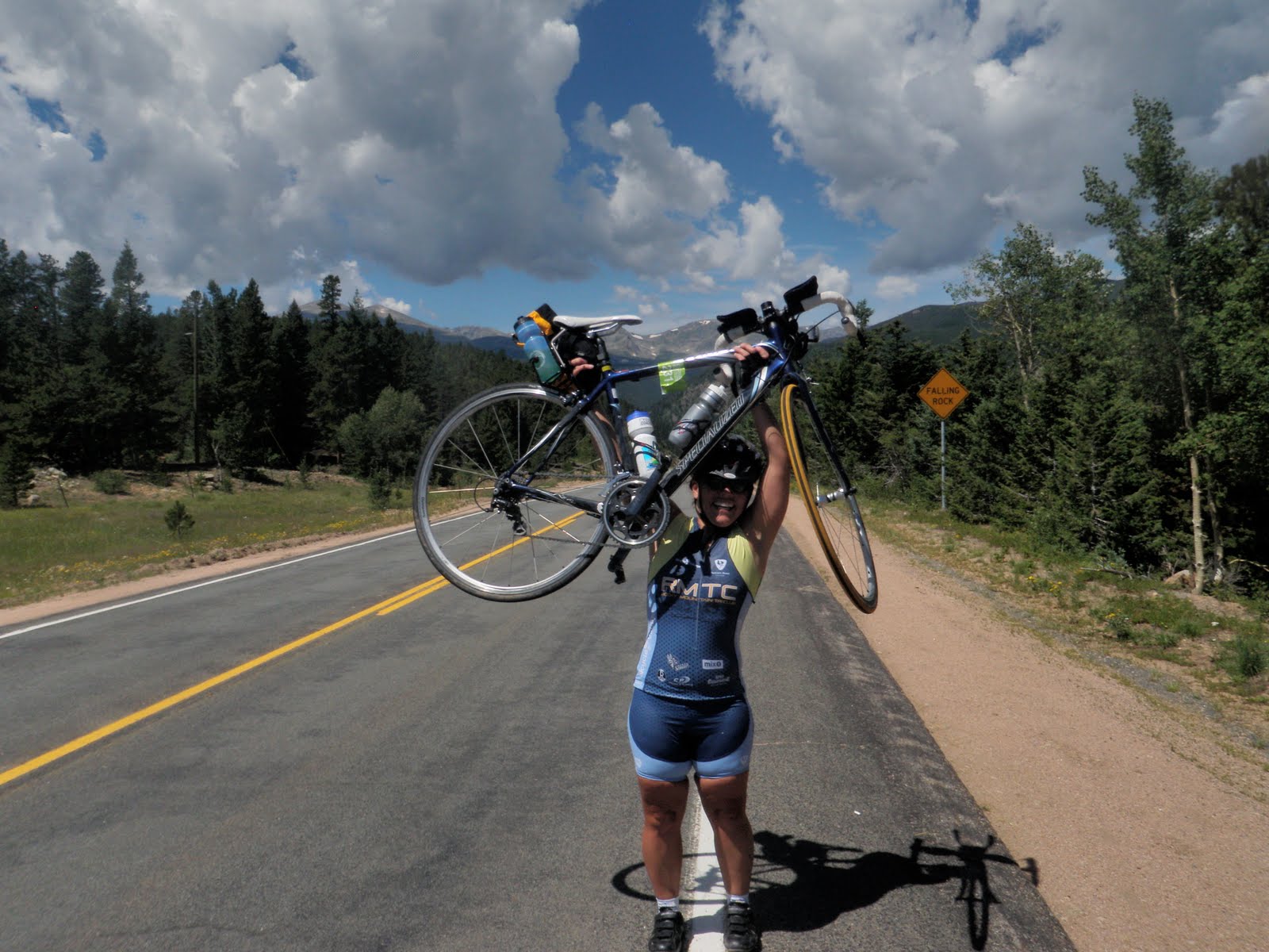
I MADE IT!

At the top, I saw Jane and Bill and numerous other riders. Everyone was elated, a little woozy (including myself), and I think just happy to be off their bikes. The last few miles I didn't feel as if I could take on any calories, but now that I had stopped riding, I gulped down a whole bottle of Gatorade and tried to stomach some nuts (didn't work). The views were marvelous and you could see so much beautiful terrain AND a view of Denver. No way! Very cool.
After just a little bit, it was time to head down. I got in my big ring and off I went. Coming down was a very technical descent, especially with NO guardrails and it was so, so cold. Stopped quickly at the aid station to have the mechanic look at my bike and then off to do more climbing. Just what I (didn't) want. But that was ok. It was only a little climb up Squaw Pass, then a long descent-- my reward for a long day. Then it was into Evergreen and over Lookout Mountain and into Golden and we were "home" for the night.

I was happy to see Sue when I checked in. She was having hip issues and had opted not to climb Mt. Evans, but she had, had a very delightful day none-the-less, taking in the scenery on Squaw Pass. That night we hung in Golden, enjoyed the first night of great weather and soaked up the city that toted Buffalo Bill Cody as their own.
Aren't we cute?

CRMBT: Day 2. Up, up, up. Down, down, down.

Knowing that this is for real, I looked at Day 2's agenda. I know, most people would have studied this prior to signing up... but I felt like since I didn't have much to compare it to, I wouldn't really know the difference. Anyways, Day 2 involved 2 passes-- Swan Mountain and Loveland Pass. Loveland Pass-- really? We ski by that pass. Actually, we ski BELOW that pass. I am going to be biking that high? Well, ok, I'll try.

The day started out kinda cloudy, which was nice, since it kept away the heat. Swan Mountain is a shorter, steeper climb, so we all kind of separated right away.

View off to the left while climbing Swan Mountain

View straight ahead

We had all kind of separated on the climb and coming down, I was colder than ever. I felt like I couldn't wait because I didn't want to get chilled, so I continued onto Keystone.

Riding through Keystone was beautiful and where the sun came out.
It is also where I got lost. If there is one area that the CRMBT can improve on it is signage and directions. There were many people that got lost at many different points in the ride-- not just me. Anyways, it was kind of good I got lost because by the time I found my way back, I got to hook-up with the rest of the group. Yay!

So, we continued on through Keystone, went a few more miles before passing this:8 miles of pure climbing. Great. Well, this will be a warm-up for tomorrow, I thought. (28 mile climb.) Luckily, there was an aid station a mile after this. We re-grouped and I told myself "just" 7 more miles.

So I went and I went and I went. I saw people pull off and take breaks. I thought about it, but then I thought I might not start up again. So, I continued on. I passed A-Basin, where we ski, and thought it was only going to get worse. I have driven over the pass and the switchbacks had to be the worst part. Ironically, when I got there, they weren't. They only seemed easier than what I had gone through. Hallelujah! So, up, up, up I went. I could see the end. Well, kind of. I knew where it was. Just up there.We passed that bend and there was still about the longest mile I had ever ridden (until the next day). But, I was excited, I was at treeline. That means 12,000 feet baby! I looked at my Garmin, which read just over 12,000 and I was happy.

Me at the top

More proof we made it!

Then it was time to DOWNHILL! This part was really fun for me. Like I said, I have been over this pass and the other side was gonna be an awesome ride! And down I went, making sure not to hit any deer on my way (seriously).

After the initial descent, we went on I-70 for a few miles then exited. I waited there for Jane and Bill to come along. We continued riding to Georgetown and stopped there for some food and drink. It was a cute town and we figured why hurry up to wait for our hotel rooms to open up? So, we found some other bikers and a nice outdoor cafe to eat at. Yum. Just what I needed. Nourishment.
"Which way to food?"

After lunch it was another ten miles or so to Idaho Springs, our final destination for the day. It was time to settle in for the day. I met Sue at our hotel just outside of town. We went for some drinks, appetizers and later met up with a bunch of the group staying at our hotel for dinner.
They were awesome and had traveled from all over to be there. They were all pretty much rock stars on their bikes.

Another good day of climbing in the books. Steeper and longer, but I knew nothing like what we had to look forward to. The following day we would be climbing Mt. Evans (if we so chose to) and that had me nervous. Still, I enjoyed my time at dinner and we settled in for a good night's sleep.

CRMBT: Day 1. 3 passes. Seriously?

So, just got back from a bike tour. Actually, I did the "lite" version of the bike tour (4 of the 6 days) and boy(!) was it hard.

Just a little background. Earlier this year, my friend Sue emailed me saying that she and a couple of friends were thinking of doing the Colorado Rocky Mountain Bike Tour and would I like to join them. I emailed Steve who said, "I think this would be good and you should try to do it even if they don't come." At this point, a light should have gone off in my head saying "BEWARE!" if Steve thinks it is a good idea, it's probably pretty difficult... But, no, didn't think any more of it and signed off on doing it. Yay! Fun trip with friends, right? Hm?

Fast forward to last week. Was happy to see Sue, Jane and Joan roll into Denver on Friday. Saturday we headed to Edwards where we hooked up with Bill, got checked in and all prepared for our ride.

Sunday we were off. The title for the ride that day was "a good start". 3 mountain passes. One at 9,000-something, 10,000-something and 11,000-something. OK, I don't think I've ever biked over 9,000, but ok.
Us starting off

Me showing off my photography skills (taking picts while riding)

So, we are riding along and I see this:
4 miles to the Summit. Ok, I can do that. As we really started climbing, we started to separate, but I just kept focused mentally. Ticked off the miles one by one. Took pictures to pass time.
Got to the top and zoom! Down I went (no picture at summit). :( Stopped at rest station. Waited for everyone and off we were again. Another summit to conquer.
Starting second climb of the day

Again, as soon as the climbing started, we started to separate. Again, saw a sign. 4 miles to summit. Can do that. Focus. And here is where we ended up!

Feeling good. One more pass to go today. Fremont Pass. This one was a tad bit harder. I think mentally it felt like you were going down, but really you were climbing. For a long, long, long time.
Going up (which really seems like down, but is really up) on the way to Fremont Pass.

Then, when you feel like you are almost done, you see a long, vertical road. BUT, at the top of it, I knew was the summit-- or at least I told myself that to get up it. And it was. WHEW! Then another descent and an aid station.

This pass was 11,318 ft- and we worked for every one of them getting up there!

Now, the real descending. Down all the way to Frisco. It was beautiful. At some point, we saw people heading up the trail. I was glad to be going down.
Views on bike path between Copper and Frisco.

Got to Frisco and was happy to be done for the day. 71 miles. 3 mountain passes. Where was my recovery drink? That would be Mix1 followed by a margarita. :)